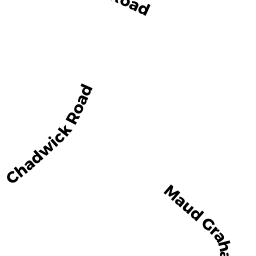
4 MAUD GRAHAM CIR
Owner Information
KENG KANG TA
4 MAUD GRAHAM CIR
BURLINGTON, MA 01803


Property Details
4 MAUD GRAHAM CIR is classified as a Single Family Residential (Split entry).
The primary structure on this property was built in 1957. There are 1,776ft2 of built area within this property. There is 1,776ft2 of residential/living space within this property. This property is listed as having 5 rooms.
4 MAUD GRAHAM CIR is valued at $502,400. The land is valued at $270,900 and the structures are valued at $231,500.
This property is in Zone RO. Confirm with local Zoning Board authorities to ensure there are no overlays or other easements on this property.
The most recent deed for 4 MAUD GRAHAM CIR is recorded at the local registrar in Book 1541, Page 54. 4 MAUD GRAHAM CIR was last sold on Friday, March 1, 2019 for $540,000.
Assessment data from fiscal year 2022.
Flood Data
This property is partially within the AE Zone (within floodplain). Approximately 0.42 acres (99.99%) of the property is within this zone.
A portion of this property is denoted as being within a floodway.
This information is sourced from the FEMA National Flood Hazard Layer. See our full disclamer.
Broadband Internet Providers
| Provider | Type | Bandwidth (mbps) | |
|---|---|---|---|
| GCI Communication Corp. | Satellite | 0 | 0 |
| RCN | Cable | 500 | 20 |
| Viasat Inc | Satellite | 100 | 3 |
| Comcast | Cable | 1000 | 35 |
| Verizon New England Inc. | Fiber | 940 | 880 |
| VSAT Systems, LLC. | Satellite | 2 | 1 |
| HughesNet | Satellite | 25 | 3 |
Broadband service provider data from December 2020.
Adjacent Properties
- 14 MAUD GRAHAM CIR
Single Family Residential owned by BELIN ASEN - 16 MAUD GRAHAM CIR
Multiple Houses on one parcel owned by PATEL RAJESH V - 18 MAUD GRAHAM CIR
Single Family Residential owned by MEE RYAN - 2 MAUD GRAHAM CIR
Single Family Residential owned by FORESTER ROBERT P - 6 MAUD GRAHAM CIR
Single Family Residential owned by MCLEAN MICHAEL A - 12 MAUD GRAHAM CIR
Single Family Residential owned by BARTOLOMEO NICOLETTA